Waterwatch Data Portal
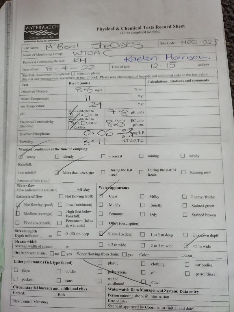
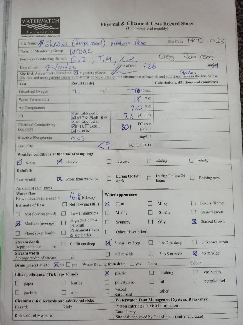
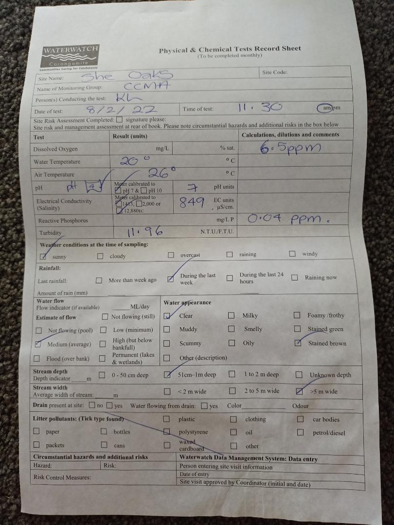
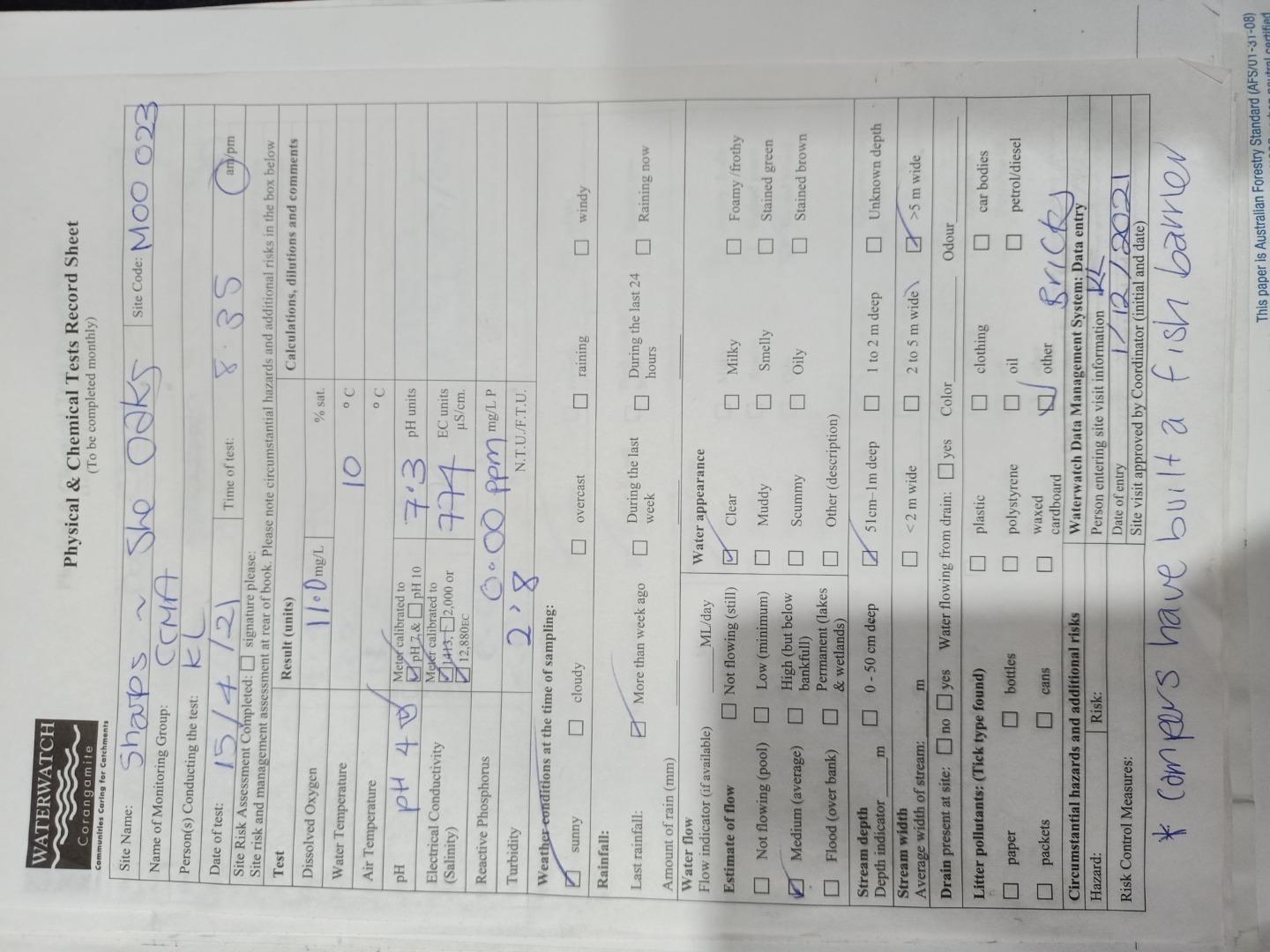
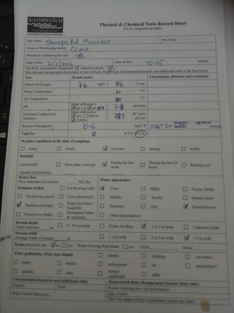
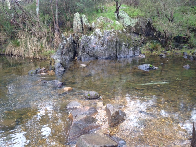
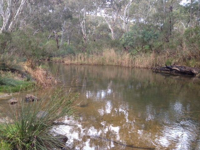
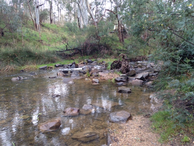
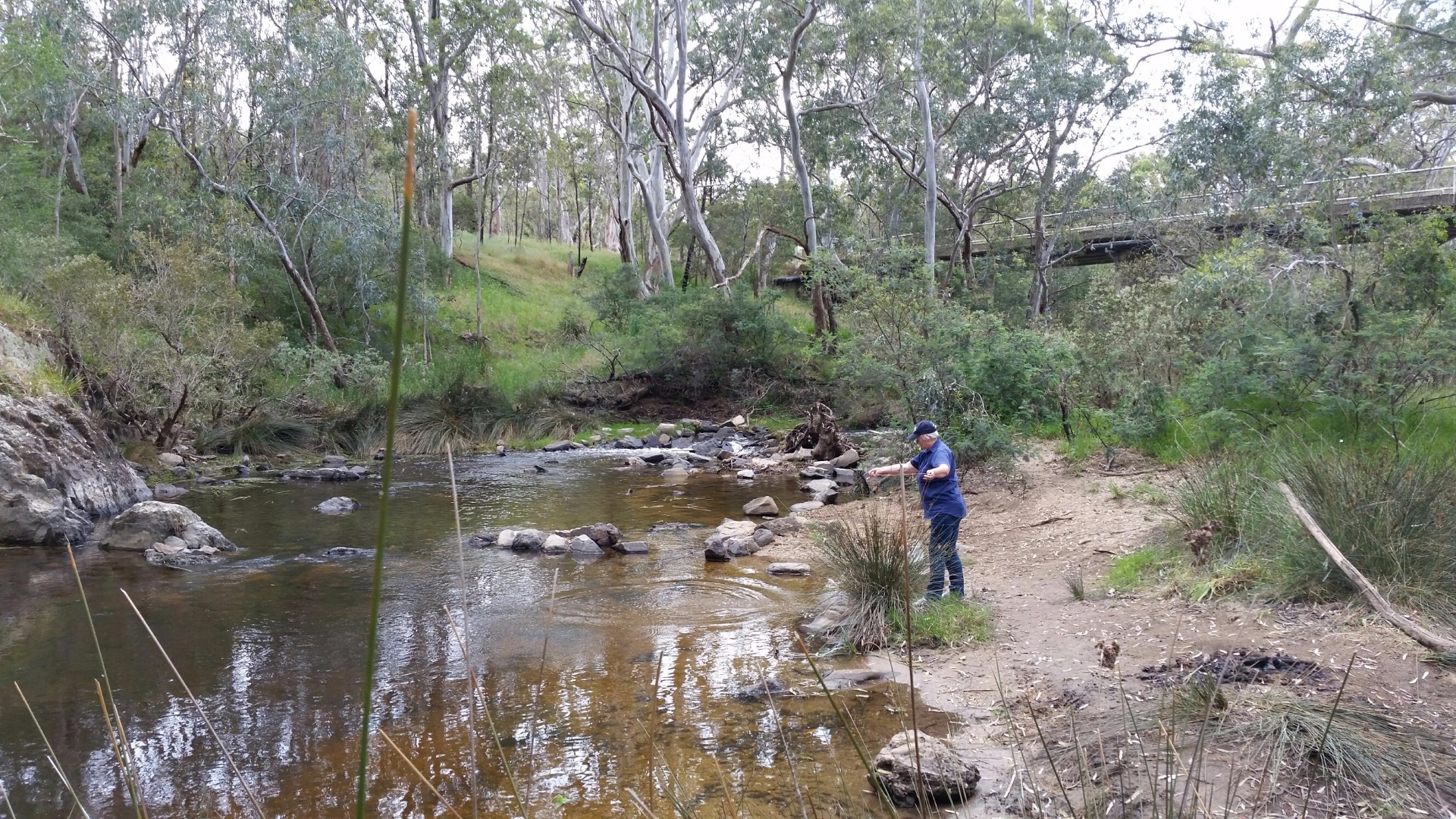
CO_MOO023 Moorabool River @ Sharps Rd crossing, She Oaks
Site details
Overview
| Site code | CO_MOO023 |
|---|---|
| Site name | Moorabool River @ Sharps Rd crossing, She Oaks |
| Status | Active |
| Water Authority | Corangamite |
| Basin | Moorabool River |
| Catchment | Moorabool River |
| Sub catchment | Moorabool River |
| Reach | 32_3 Moorabool River |
| Water type | Other |
| Council | |
| History | View all 34 site visits 01-11-2004 - 29-06-2023 |
| Monitoring organisations |
|
 Loading chart
Habitat
| Date | Comment | Bank Erosion Stability | Bank Vegetation | In Stream Cover | Riffles Pools Bends | Verge Vegetation | Overall |
|---|---|---|---|---|---|---|---|
| 01-11-2004 | Lomandra, nobby club brush, river reds, silver wattle, gorse - ulex europaes, river bottle brush,virch (?) | Poor 2 | VeryPoor 2 | Fair 6 | VeryPoor 1 | Poor 4 | Good 15 |


All content, files, data and images provided by the Waterwatch Data Portal and Gallery are subject to a Creative Commons Attribution License
Content is made available to be used in any way, and should always attribute Waterwatch and www.vic.waterwatch.org.au
.png)