Waterwatch Data Portal
Site details
Overview
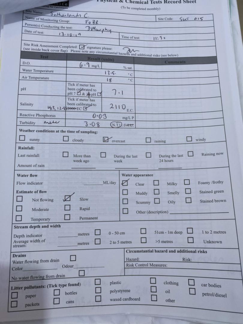
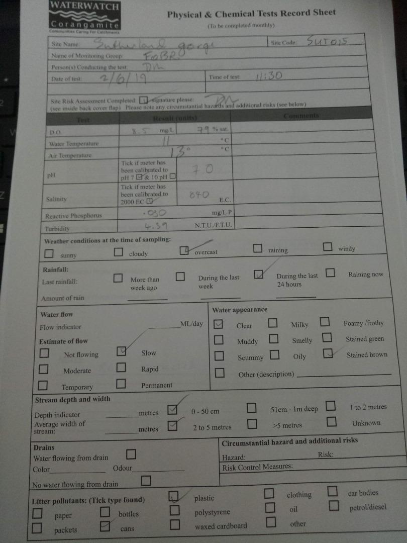
| Site code | CO_SUT015 |
|---|---|
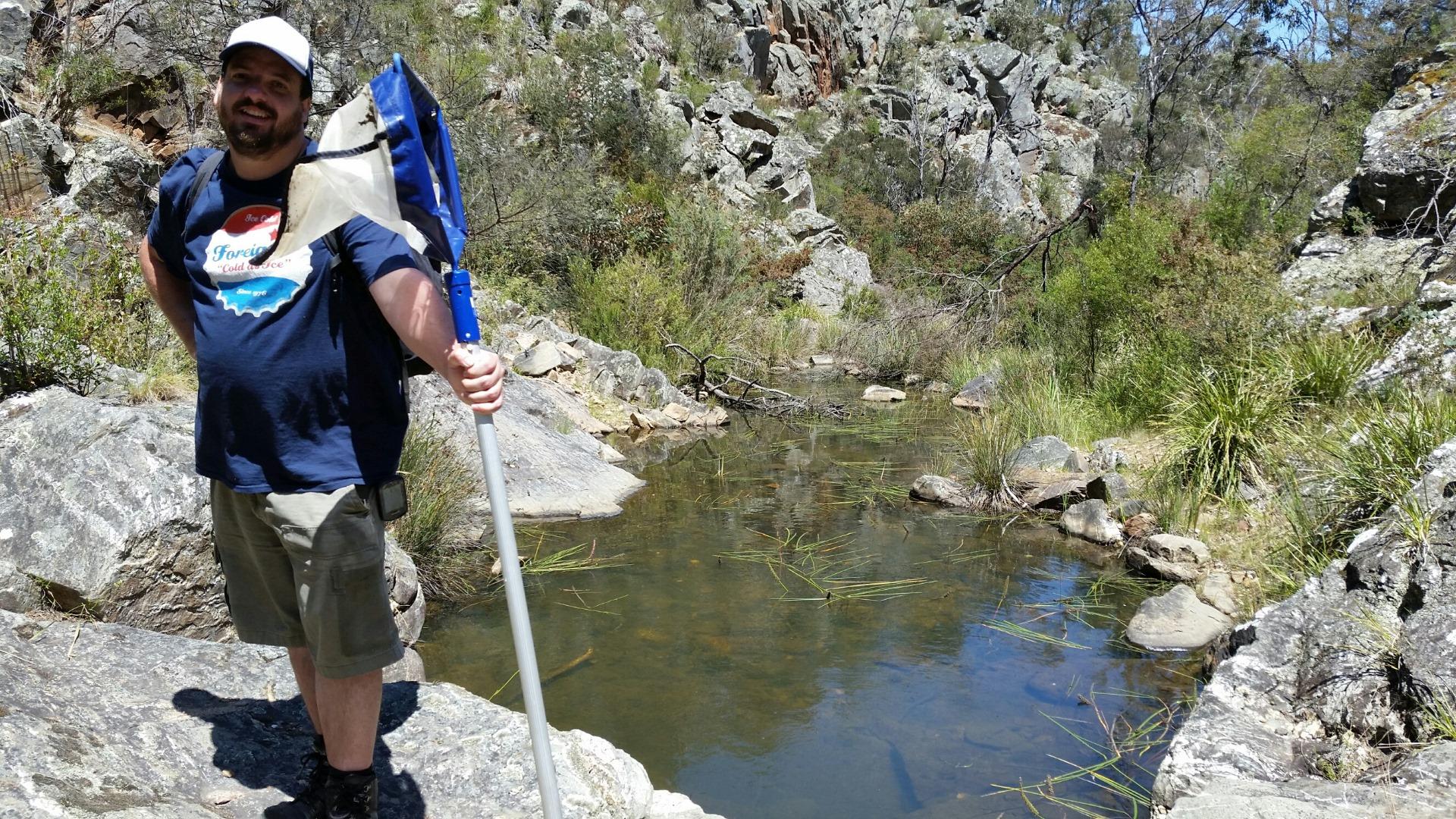
| Site name | Sutherland Creek at gorge, Steiglitz |
| Status | Active |
| Water Authority | Corangamite |
| Basin | Moorabool River |
| Catchment | Moorabool River |
| Sub catchment | Sutherland Creek |
| Reach | 32_8 Sutherland Creek West Branch |
| Water type | Other |
| Council | |
| History | View all 30 site visits 20-06-2010 - 08-09-2024 |
| Monitoring organisations |
Site visits
 Loading chart
| Date | D.O. % | D.O mg/L | EC µS/cm | pH pH Units | rP mg/L P | Air ° C | Water ° C | Turb NTU |
|---|---|---|---|---|---|---|---|---|
| 09-07-2023 | 46 | 4.9 | 4570 | 7.4 | 0.01 | 15 | 11 | 9 |
| 17-03-2024 | 81.58 | 7.29 | 3675 | 7.4 | 0.005 | 29 | 20.3 | 9 |
| 08-09-2024 | 51.24 | 5.2 | 4660 | 6.7 | 0.03 | 17 | 14 | 10 |
Habitat
| Date | Comment | Bank Erosion Stability | Bank Vegetation | In Stream Cover | Riffles Pools Bends | Verge Vegetation | Overall |
|---|---|---|---|---|---|---|---|
| 09-11-2014 | Site in BR N Park, walking track nearby | Excellent 5 | Excellent 10 | Good 8 | Excellent 5 | Good 8 | Excellent 36 |
| 16-09-2012 | Presence of spiny rush lowered score for bank vegetation. Stream cover is naturally sparse. | Excellent 5 | Good 8 | Good 8 | Excellent 5 | Excellent 10 | Excellent 36 |
| 11-11-2010 | Site in Steiglitz Historinal Park (Parks Vic). Accessed by walking track - Deadmans Loop. This gorge area has nearby mine shafts. The creek has a permanent pool. Phytophera risk | VeryPoor 1 | VeryPoor 2 | Poor 4 | VeryPoor 1 | VeryPoor 2 | Excellent 10 |


All content, files, data and images provided by the Waterwatch Data Portal and Gallery are subject to a Creative Commons Attribution License
Content is made available to be used in any way, and should always attribute Waterwatch and www.vic.waterwatch.org.au
.png)