Waterwatch Data Portal
Site details
Overview
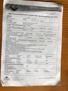
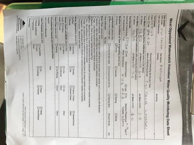
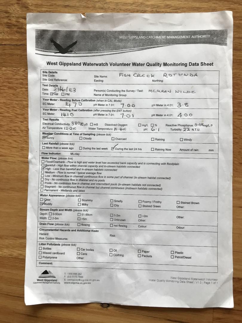
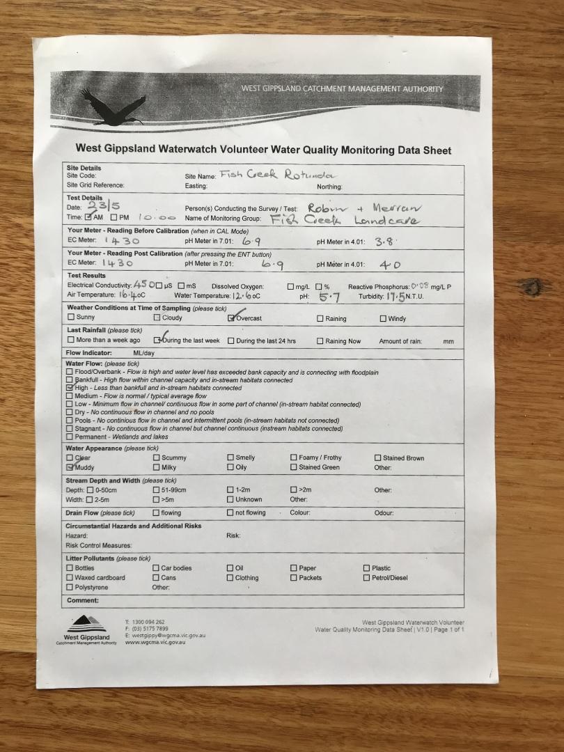
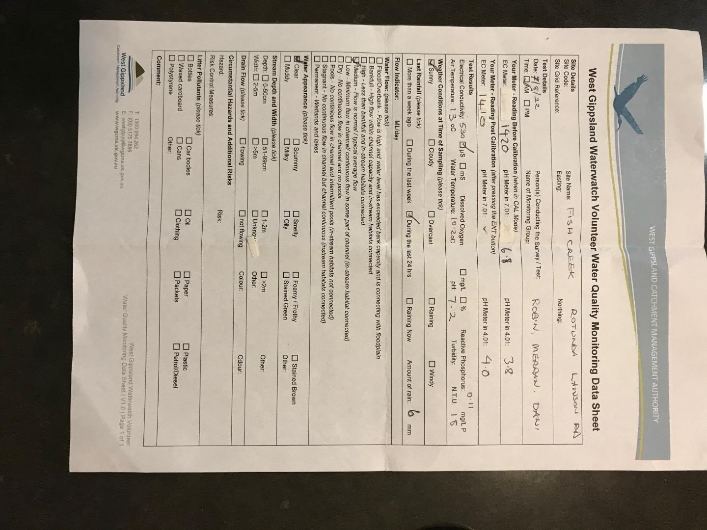
| Site code | WG_FSC007 |
|---|---|
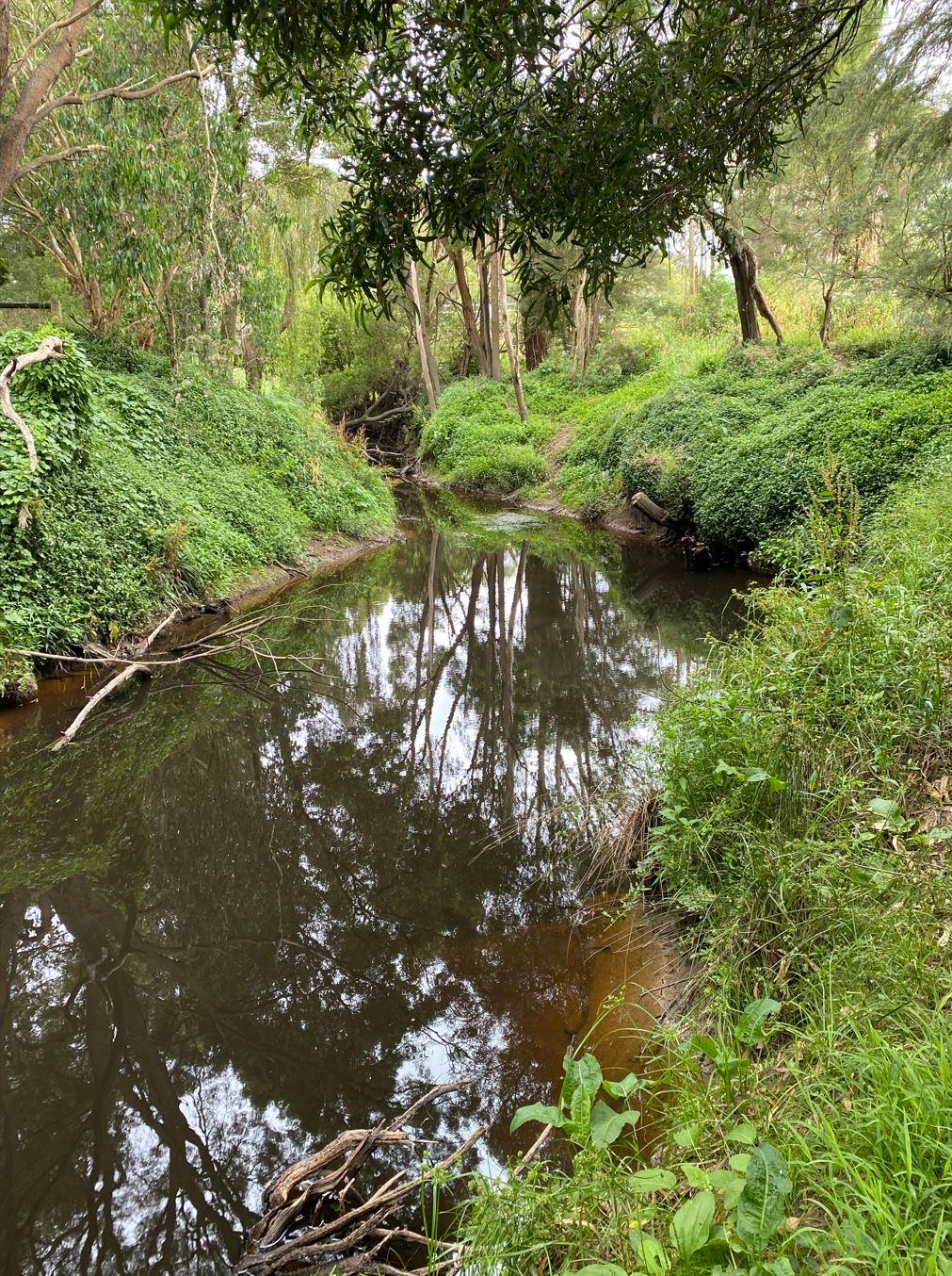
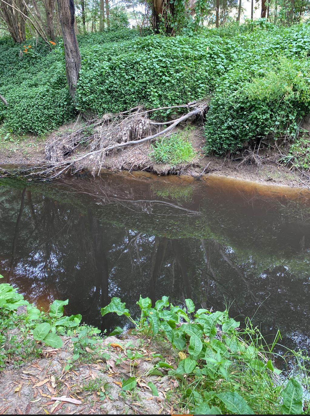
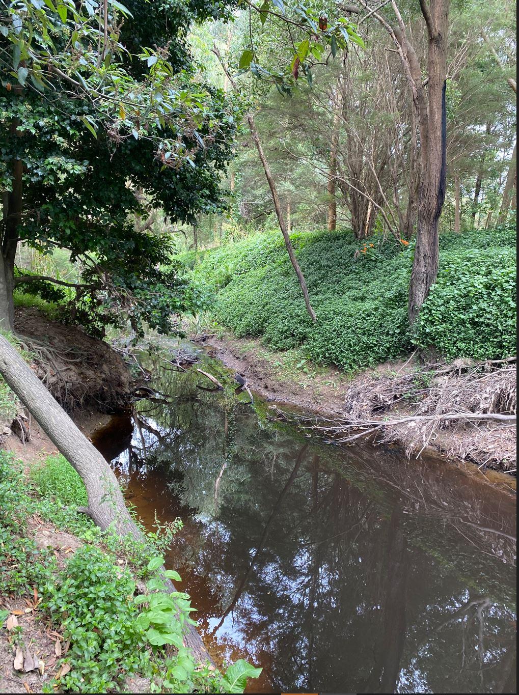
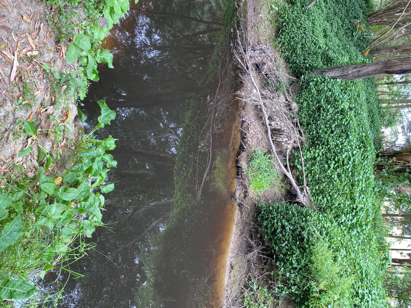
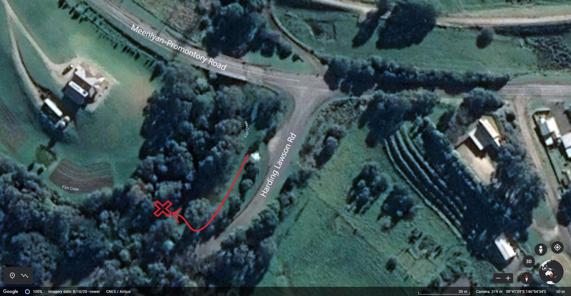
| Site name | FIsh Creek, Rotunda |
| Status | Active |
| Water Authority | West Gippsland |
| Basin | South Gippsland |
| Catchment | South Gippsland |
| Sub catchment | Fish Creek |
| Reach | 27_13 Fish Creek |
| Water type | Creek |
| Council | South Gippsland Shire Council |
| History | View all 35 site visits 18-06-2021 - 18-12-2024 |
| Monitoring organisations |
|
Site visits
 Loading chart
| Date | EC µS/cm | pH pH Units | rP mg/L P | Air ° C | Water ° C | Turb NTU |
|---|---|---|---|---|---|---|
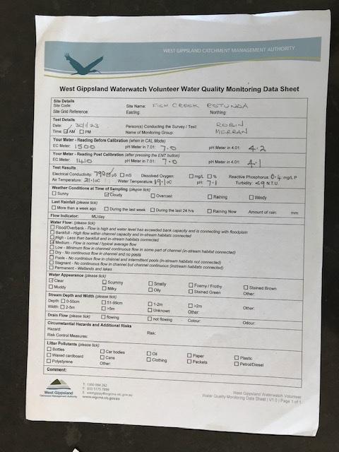
| 30-01-2023 | 790 | 7.1 | 0.4 | 21.1 | 19.1 | 9 |
| 31-01-2023 | ||||||
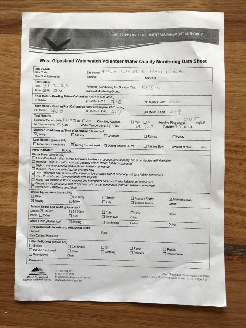
| 31-03-2023 | 1140 | 6.2 | 0.02 | 18.3 | 14.1 | 9.5 |
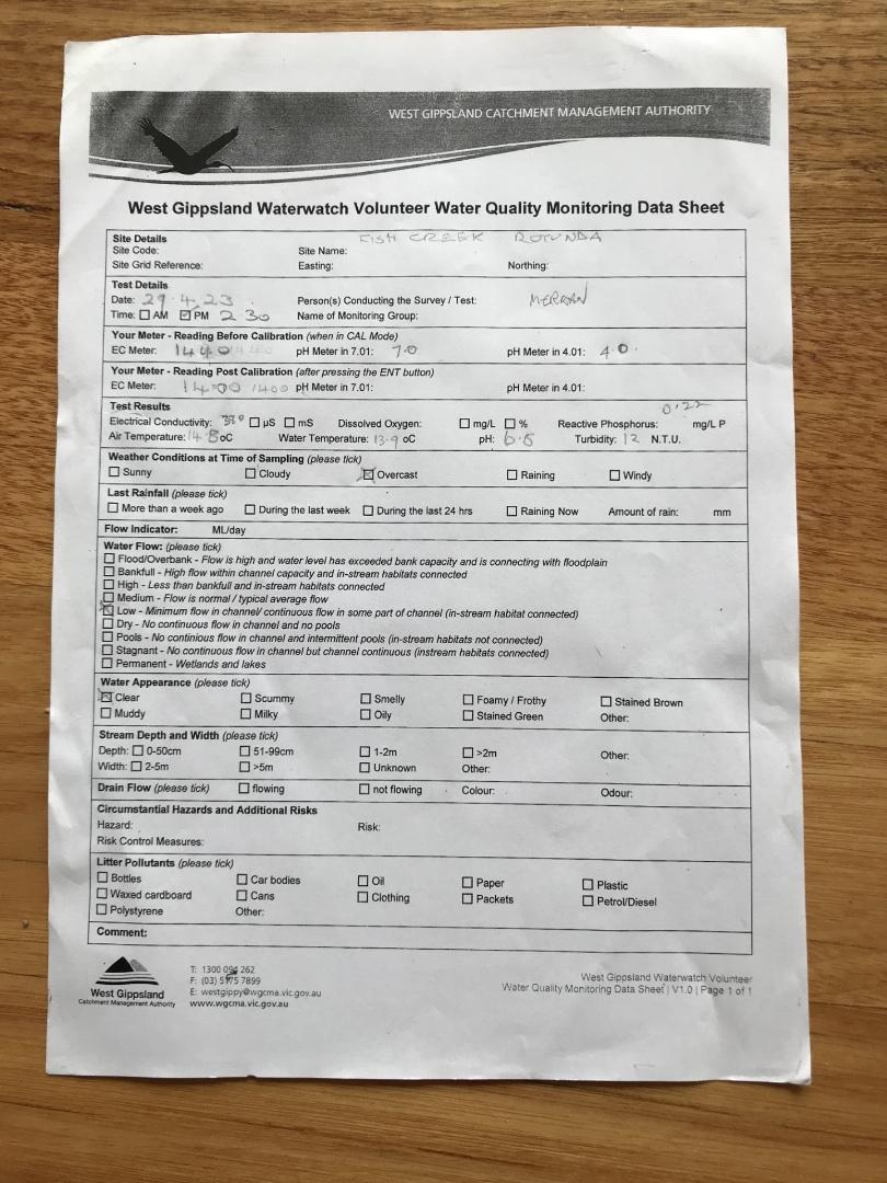
| 29-04-2023 | 380 | 6.5 | 0.22 | 14.8 | 13.9 | 12 |
| 23-05-2023 | 450 | 5.9 | 0.08 | 16.4 | 12.6 | 17.5 |
| 23-06-2023 | 380 | 6.1 | 0.08 | 12.2 | 10.4 | 22 |
| 09-07-2023 | 450 | 6.5 | 0.11 | 17.1 | 11.7 | 16.5 |
| 29-07-2023 | 450 | 6.5 | 0.11 | 17.1 | 11.7 | 16.5 |
| 30-09-2023 | 570 | 6.3 | 0.14 | 17.8 | 15.2 | 14.5 |
| 31-10-2023 | 380 | 6.4 | 0.15 | 14.6 | 14.3 | 55 |
| 30-11-2023 | 280 | 6 | 0.09 | 16.5 | 14 | 60 |
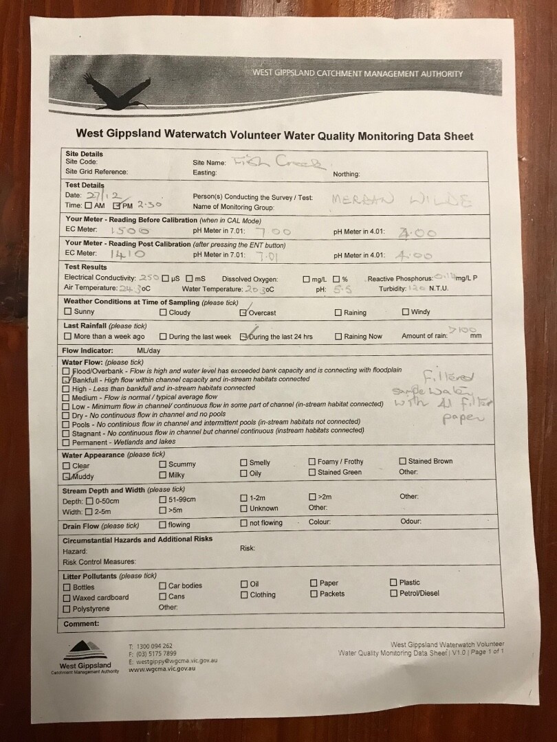
| 27-12-2023 | 250 | 5.5 | 0.14 | 24.3 | 20.3 | 120 |
| 31-01-2024 | 540 | 6.2 | 0.14 | 20.7 | 19.9 | 16 |
| 29-02-2024 | 650 | 6.2 | 0.11 | 21.9 | 18.9 | 50 |
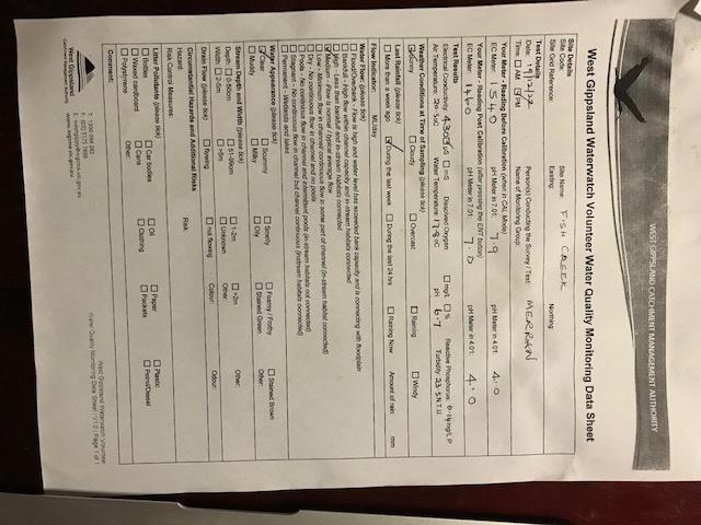
| 07-04-2024 | 687 | 6 | 0.07 | 20.4 | 18.3 | 23 |
| 13-05-2024 | 710 | 7.4 | 0.08 | 19 | 14.6 | 12.5 |
| 13-05-2024 | 710 | 7.4 | 0.08 | 19 | 14.6 | 12.5 |
| 18-06-2024 | 550 | 6.9 | 0.11 | 12.2 | 9 | 9 |
| 18-06-2024 | 550 | 6.9 | 0.11 | 12.2 | 9 | 9 |
| 10-08-2024 | 480 | 6.7 | 0.11 | 19.4 | 11.6 | 12.5 |
| 10-08-2024 | 480 | 6.7 | 0.11 | 19.4 | 11.6 | 12.5 |
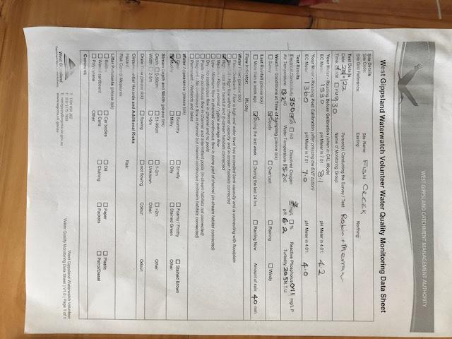
| 04-11-2024 | 550 | 6.9 | 0.14 | 21 | 18.6 | 26 |
| 18-12-2024 | 730 | 7.7 | 0.06 | 21 | 20.5 | 13.5 |
Habitat
| Date | Comment | Bank Erosion Stability | Bank Vegetation | In Stream Cover | Riffles Pools Bends | Verge Vegetation | Overall |
|---|---|---|---|---|---|---|---|
| 13-05-2024 | Fair 3 | Poor 4 | Poor 4 | Poor 2 | Poor 4 | 17 | |
| 31-01-2023 | Fair 3 | Poor 4 | Fair 6 | Poor 2 | Fair 6 | 21 | |
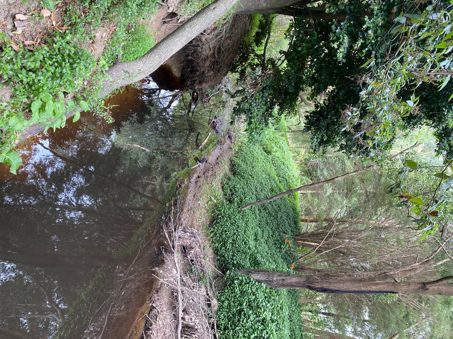
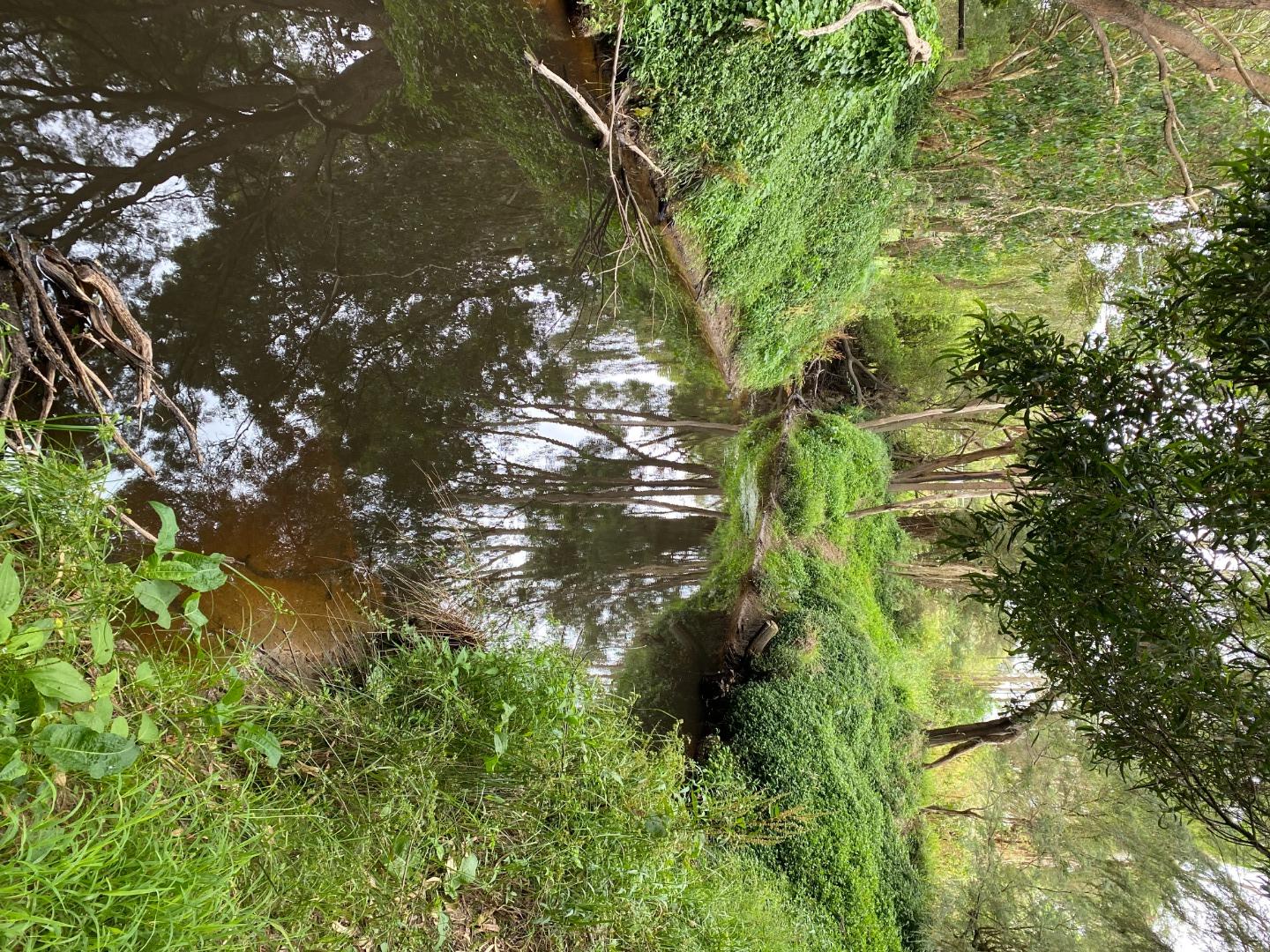
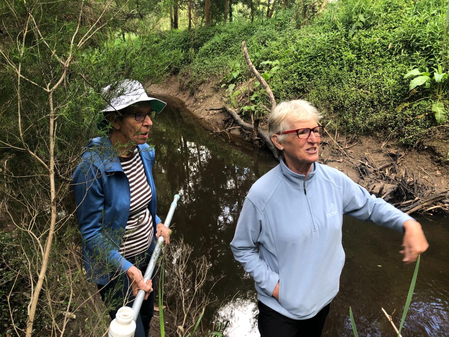
| 03-12-2021 | <p>Length of stream examined: 50 m</p> <p>Plants and animals observed near stream: Water ribbons in stream. No aquatic invertebrates observed.</p> | Fair 3 | VeryPoor 2 | Fair 6 | Fair 3 | Fair 6 | 20 |


All content, files, data and images provided by the Waterwatch Data Portal and Gallery are subject to a Creative Commons Attribution License
Content is made available to be used in any way, and should always attribute Waterwatch and www.vic.waterwatch.org.au
.png)