Waterwatch Data Portal
ME_YSC099 Mt Waverley Wetlands at the rocky embankment at the most westerly end, nearest Blackburn Rd
21 March 2010
Site visit details
Overview
| Catchment | Yarra River |
|---|---|
| Site | Mt Waverley Wetlands at the rocky embankment at the most westerly end, nearest Blackburn Rd ME_YSC099 |
| Date and Time | Sunday 21st March 2010 14:00pm |
| Approved | Approved |
Physical Chemical Tests
| Ammon-Nit mg/L NH3-N | N mg/L NH4+ | D.O. % | D.O mg/L | EC µS/cm | FrP mg/L P | Nitrate-Nit mg/L N | pH pH Units | rP mg/L P | Air ° C | Water ° C | Turb FTU | Turb NTU | |
|---|---|---|---|---|---|---|---|---|---|---|---|---|---|
| Sample | 2.4 | 480 | 0.02 | 7.1 | 20 | 17.5 |
| Weather | n/s |
|---|---|
| Last rainfall | More than a week ago |
| Flow estimate | n/s |
| Water Appearance | |
| Stream depth | |
| Stream width | |
| Hazards | |
| Litter/Pollutants |
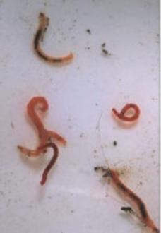
Last rainfall not specified. ? The first pond of the wetlands (site 4) is now at its correct level, after fluctuations during remedial work and the storm of 6th March. Unusually, all the ?mosquito fish? found in the invertebrate sampling were dead. The last pond of the wetlands (site 5) yielded an invertebrates sample thick with green algae, which made counting difficult, however in contast to site 4 there were many live ?mosquito fish?. ? Oxygen levels in both wetlands sites are degraded.
Creatures Waterwatch method
| Total bug score | ||
|---|---|---|
| Total abundance | 0 - 35 | 35+ |
| 0 - 200 | Poor | Good |
| 200+ | Fair | Very good |

All content, files, data and images provided by the Waterwatch Data Portal and Gallery are subject to a Creative Commons Attribution License
Content is made available to be used in any way, and should always attribute Waterwatch and www.vic.waterwatch.org.au

