Waterwatch Data Portal
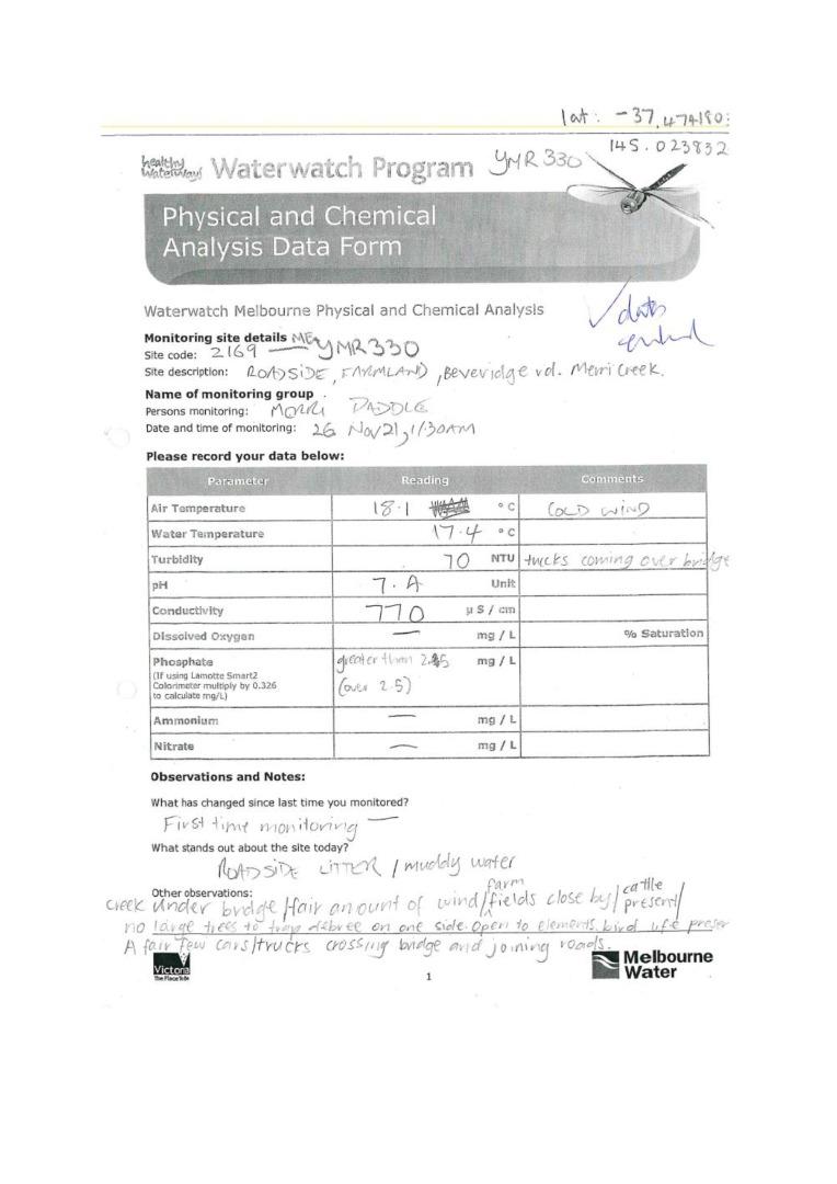
ME_YMR330 Merri Creek at close to Beveridge and Merriang Road, Beveridge
26 November 2021
Site visit details
Overview
| Catchment | Yarra River |
|---|---|
| Site | Merri Creek at close to Beveridge and Merriang Road, Beveridge ME_YMR330 |
| Date and Time | Friday 26th November 2021 11:30am |
| Approved | Approved |
Physical Chemical Tests
| N mg/L NH4+ | D.O. % | EC µS/cm | pH pH Units | rP mg/L P | Air ° C | Water ° C | Turb NTU | |
|---|---|---|---|---|---|---|---|---|
| Sample | 770 | 7.4 | 2.5 | 18.1 | 17.4 | 70 |
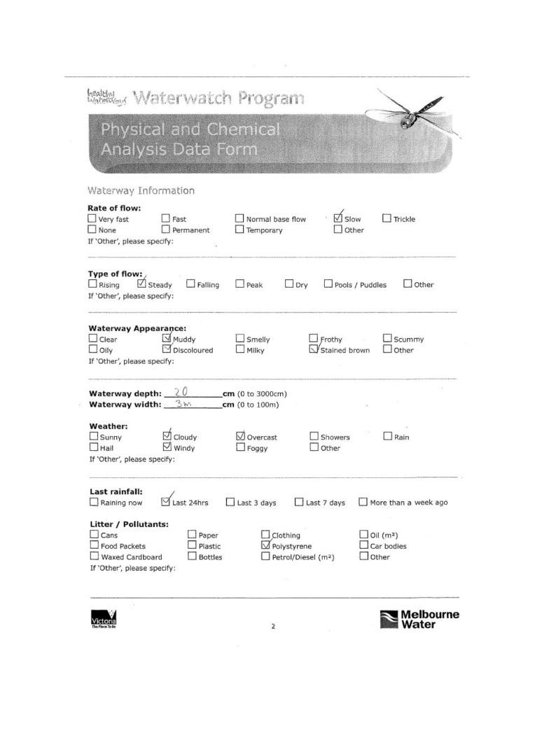
| Weather | overcast |
|---|---|
| Last rainfall | During the last 24 hours |
| Flow estimate | LOW: Minimum flow in channel/continuous flow in some part of channel (in-stream habitats connected) |
| Water Appearance | Stained brown,Muddy |
| Stream depth | 0 - 50cm |
| Stream width | 2m - 5m |
| Hazards | |
| Litter/Pollutants | polystyrene |
There was some roadside litter.
It was a creek under a bridge used as a road for cars and trucks. Fair amount of wind on testing day.
Farm fileds close by containing cattle. No large trees to trap debree on one side. Open to the elements. Only grazing grass present as a plant species up stream.
Joining roads over location also.

All content, files, data and images provided by the Waterwatch Data Portal and Gallery are subject to a Creative Commons Attribution License
Content is made available to be used in any way, and should always attribute Waterwatch and www.vic.waterwatch.org.au


