Waterwatch Data Portal
NC_BUL120 Bullock Creek: Upper Spring Ck Landcare, B3
4 May 2024
Site visit details
Overview
| Catchment | Loddon River |
|---|---|
| Site | Bullock Creek: Upper Spring Ck Landcare, B3 NC_BUL120 |
| Date and Time | Saturday 4th May 2024 10:30am |
| Approved | Approved |
Physical Chemical Tests
| EC µS/cm | pH pH Units | rP mg/L P | Air ° C | Water ° C | P mg/L | Turb NTU | |
|---|---|---|---|---|---|---|---|
| Sample | 3700 | 7.1 | 0.05 | 15 | 11.5 | 21 |
| Weather | overcast |
|---|---|
| Last rainfall | More than a week ago 1.50 |
| Flow estimate | POOLS: No continuous flow in channel and intermittent pools (in-stream habitats not connected) |
| Water Appearance | Scummy,Stained brown,Muddy,Oily |
| Stream depth | 0 - 50cm |
| Stream width | < 2m |
| Hazards | long grass |
| Litter/Pollutants | bottles,paper,plastic,waxed cardboard,cans,packets,polystyrene |
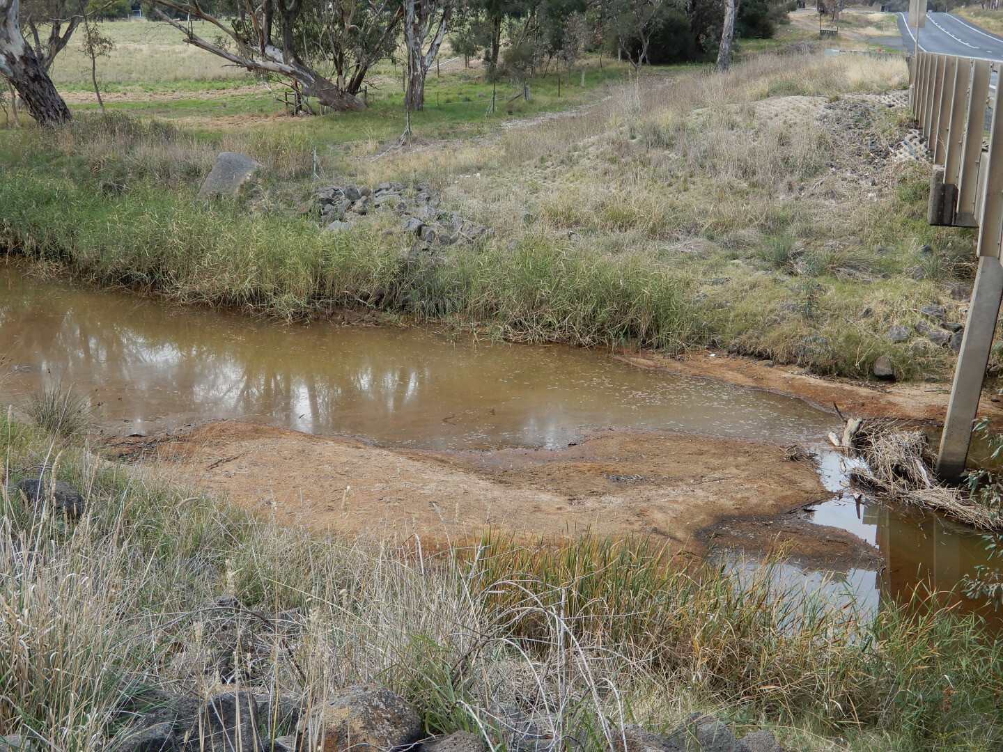
A sandbar, under the adjacent road bridge, formed a few months ago and is now large enough to prevent Bullock Creek flowing downstream under normal conditions. The second photo shows this sandbar under the Calder Highway bridge.


All content, files, data and images provided by the Waterwatch Data Portal and Gallery are subject to a Creative Commons Attribution License
Content is made available to be used in any way, and should always attribute Waterwatch and www.vic.waterwatch.org.au
.png)