Waterwatch Data Portal
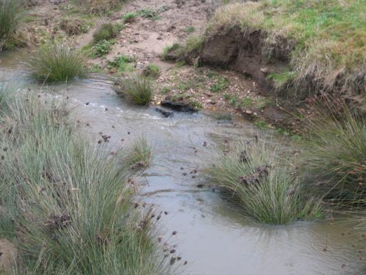
CO_MOE070 Moorabool River East branch @ Egerton-Ballark Rd
9 June 2012
Site visit details
Overview
| Catchment | Moorabool River |
|---|---|
| Site | Moorabool River East branch @ Egerton-Ballark Rd CO_MOE070 |
| Date and Time | Saturday 9th June 2012 13:45pm |
| Approved | Approved |
Physical Chemical Tests
| D.O. % | D.O mg/L | EC µS/cm | pH pH Units | rP mg/L P | Air ° C | Water ° C | P mg/L | Turb NTU | |
|---|---|---|---|---|---|---|---|---|---|
| Sample | 65 | 7.3 | 1000 | 7.7 | 0 | 10 | 10 | 27 |
| Weather | overcast |
|---|---|
| Last rainfall | During the last 24 hours 1.2 |
| Flow estimate | MEDIUM: flow is normal/typical average flow |
| Water Appearance | Muddy |
| Stream depth | 0 - 50cm |
| Stream width | 2m - 5m |
| Hazards | |
| Litter/Pollutants |

All content, files, data and images provided by the Waterwatch Data Portal and Gallery are subject to a Creative Commons Attribution License
Content is made available to be used in any way, and should always attribute Waterwatch and www.vic.waterwatch.org.au
.png)