Waterwatch Data Portal
CO_MOO001 Moorabool R confluence east & west branches, Dolly Creek Rd, Morrisons
5 May 2016
Site visit details
Overview
| Catchment | Moorabool River |
|---|---|
| Site | Moorabool R confluence east & west branches, Dolly Creek Rd, Morrisons CO_MOO001 |
| Date and Time | Thursday 5th May 2016 14:40pm |
| Approved | Approved |
Physical Chemical Tests
| D.O. % | D.O mg/L | EC µS/cm | pH pH Units | rP mg/L P | Air ° C | Water ° C | Turb NTU | |
|---|---|---|---|---|---|---|---|---|
| Sample | 69 | 7 | 2700 | 7.9 | 0 | 16 | 13 | 9 |
| Weather | windy |
|---|---|
| Last rainfall | During the last week 14 |
| Flow estimate | LOW: Minimum flow in channel/continuous flow in some part of channel (in-stream habitats connected) |
| Water Appearance | Muddy |
| Stream depth | 0.01 |
| Stream width | 2m - 5m |
| Hazards | |
| Litter/Pollutants |
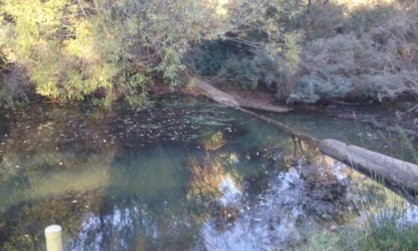
When looking at the river the water had a really muddy appearance however when testing turbidity the result was far better than you would of actually thought. I checked the river further upstream 600m and it still appeared muddy. When checking downstream 1600m at MOO 004 the river appeared clear.

All content, files, data and images provided by the Waterwatch Data Portal and Gallery are subject to a Creative Commons Attribution License
Content is made available to be used in any way, and should always attribute Waterwatch and www.vic.waterwatch.org.au


